Australia’s country way
Central Queensland is home to the world’s largest coals mines, but it also has many hidden attractions and a network of sealed roads, making for a great holiday destination.
Free Campsites
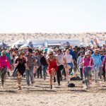
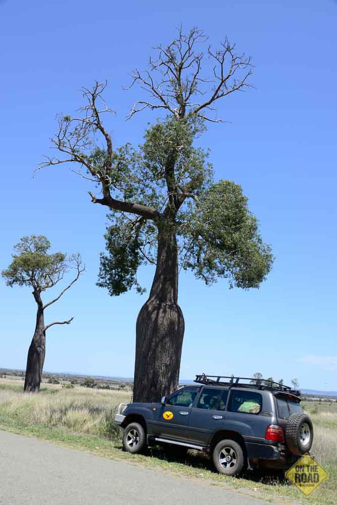
Many Qld Shire Councils have discovered that moving so-called illegal campers and grey nomads on, does nothing for local business and a large number of free campsites are scattered along the routes where staying for a few days is encouraged. However pit stops are rare and regulated to towns and roadhouses. The RV Friendly signs welcome you at almost every community. Fuel prices were a pleasant surprise as fuel was priced to match those on the coast, and well below what I pay in Mareeba and Cairns, both noted fuel rip-off places, thus it pays to fill up before you head to the Atherton Tablelands.


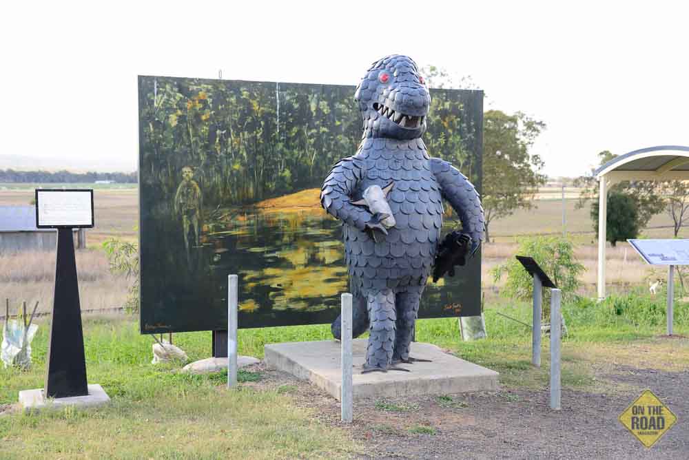
The Mulgildie Bunyip
While we have legendary yowies roaming our woods, we also have a bunyip, a creature that dwells in swamps and waterholes. It eats little children and the legend is based on Indigenous dreamtime stories to scare kids away from dangerous waters. The most enduring is the one on the Mulgildie Plain, south of Monto, where the Bunyip Waterhole is said to bubble and boil and make strange noises. The resident bunyip even ate stock and drovers would not camp there. Swim at your own risk in the legendary Bunyip Hole…
The Country Way
My wife, Eileen and I recently took a 4200km October drive through the “guts” of the Sunshine State. The drive was unplanned as we had to attend the funeral of a brother-in-law in Nambour. Instead of taking the coastal route from our home at Mareeba we headed directly south to Emerald on the Central Highlands, via Charters Towers, in a region that is dubbed “Australia’s Country Way.”
We had limited time available and thus missed many of the great national parks and other natural attractions that the Country Way is gifted with. However on the drive we discovered some amazing scenic routes that anyone towing a caravan/camper can comfortably do in the family car. As such this article is aimed at providing information on what the Central Highways and its network of sealed roads offer. If you ever wanted to return to Qld, but are tired of the busy Bruce Highway, there are great alternate inland routes that guide you directly north into the balmy dry season weather of the tropics this winter.
The Middle Route
The drive took us as far south as Caloundra and Glasshouse. From Mareeba south are the beautiful verdant Atherton Tablelands and its many attractions that include mountain ranges, waterfalls, great fishing and birdwatching. The region attracts 1000s of visitors annually; many who make it their winter home in the dry season.
Our route south from Mareeba was via the Kennedy Developmental Road, which intersects the Gregory Developmental Road at the Lynd Junction near Greenvale. The Gregory link terminates at Emerald. Apart from about four short single-lane sealed “beef road” sections north of Charters Towers, the road is double lane and fully sealed. There is a number of free camping sites along the road, including wonderful Eumara Springs.
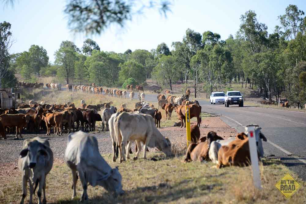
We encountered drought conditions from Ravenshoe down to Belyando Crossing from where we were pleasantly surprised to find richly grassed “downs” country that had received good rains with farmers harvesting wheat and the backs of cattle in tall grasses. We even came across a drover and a herd of cattle in the “long paddock,” a term described for a stock route or a road that is fenced on both sides. This was a real bonus and the drover was happy to pose for a few photos.
The Central Highlands are quite large and have all facilities. Clermont was dying decades ago but it has evolved into an important mining and farming community. The Highlands were once covered by brigalow scrub (Bricklow), a bushy 10m high acacia tree, but during the 1960/70 thousands of hectares were cleared and blocks opened up for farming. Only Blair Athol had a coal mine, but the clearings revealed more coal and the rest is history with the highlands now one of the largest coal producers on the globe. Clearing the bush also created a mini-climate change and altered the once reliable rainfall of the region.
While the antis say the Central Highlands are one huge open coal pit, this is far from true as the mines are widely scattered. But the bonus is that there is a huge network of sealed roads that connect mines and towns making it an ideal drive destination.
The Central Highlands
At Capella the sun set over the remarkable Peak Range lighting up its razor peaks. We booked in at a motel at Emerald and were on the Dawson Highway to Springsure early. The Fairburn Dam is en route while the town is the northern gateway to the Carnarvon National Park. Mount Boorambool (500m) guards over Springsure. One of its rocky outliers is known as Virgin Rock after the Virgin Mary. From Springsure we headed to the east coast, via Moura.
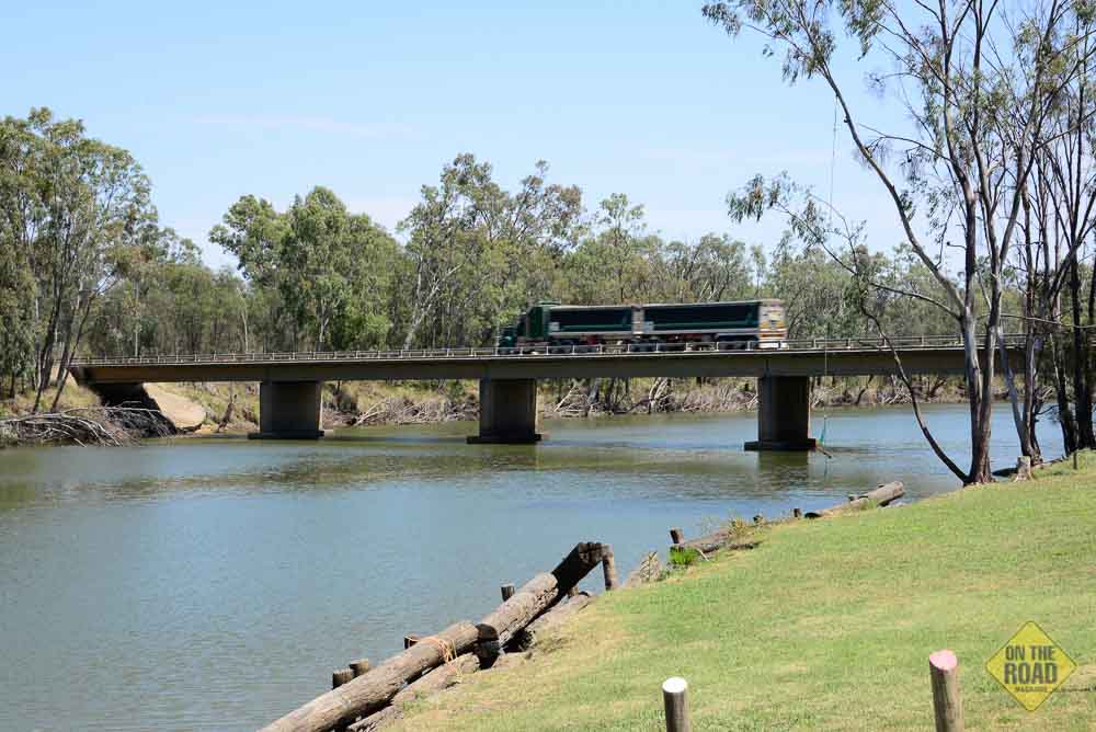
This is hilly country, with crop and beef farming in evidence. Where the highway crossed the Expedition Range it passes through rare inland plateau rainforest before diving down steeply into the verdant Dawson River valley. There is a lot of big prickly pear cactus about. It once threatened to take over but it fell back when a cactus-eating moth was introduced. There is comfortable free camp ground on the Dawson River weir at Moura. The river is home to golden perch and the Dawson River saratoga which was correctly identified by Dr. Ludwig Leichhardt on his 1844/5 expedition.
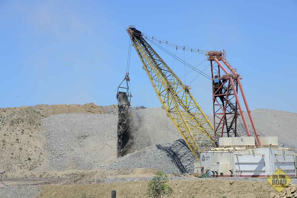
From Moura we turned south to Theodore, and passed several working coal mines. The road runs under the haul road of a mine where a huge shovel was busy shifting overburden. There is a war going on between farmers and miners as the ever-increasing expansion of coal bodies encroaches on productive farm lands, but the multinationals have more rights than our Aussie food providers and it’s a lost battle…
Cracow was our next town. It has an underground gold mine and it’s sited in the Gilbert Range. The country is very scenic and special. From Eidsvold we turned to Biggenden, via Gayndah, the citrus capital of OZ. At Biggenden we took the Brooweena Road, which has scenic views of the Mount Walsh N/P. The road is single lane and was not maintained. This once rich farming region was suffering from drought and local Government disregard as the road was in a poor state and neglected farms, including a couple of small communities that resembled something you see in a hill-billy movie, were very much in evidence.
Our two day journey ended at Hervey Bay, a large tourist town where we were suddenly tossed back in the real world of noisy traffic and hurried motorists. We did the family gathering bit at Nambour before heading south and attended an outdoor products show at Caloundra. What an eye opener that was as we never knew there were so many caravans, campers and motorhomes on the market.
The Inner Route
We spent a night with good friends Jamie and Natalie Hazelden at their Glasshouse home. Jamie, “The Australian Bushman” is well known for his DVD offroad presentations and Channel Ten’s, “The Offroad Adventure.” Our next destination was Biloela, via Kingaroy. The drive was pleasant enough with traffic being light and myriad scenic views.
We drove into Moura that evening and the next morning we made it to the Capricorn Highway, via Wowan. We turned north onto the Fitzroy Developmental Road at Dingo, stopping for lunch at Middlemount and finding the dearest fuel prices of the entire trip. Heading west to Capella we turned off onto the Dysart Road and 12km later on the Coonburragee Road, a maintained dirt road, our destination the Peak Range.
A Remarkable Range
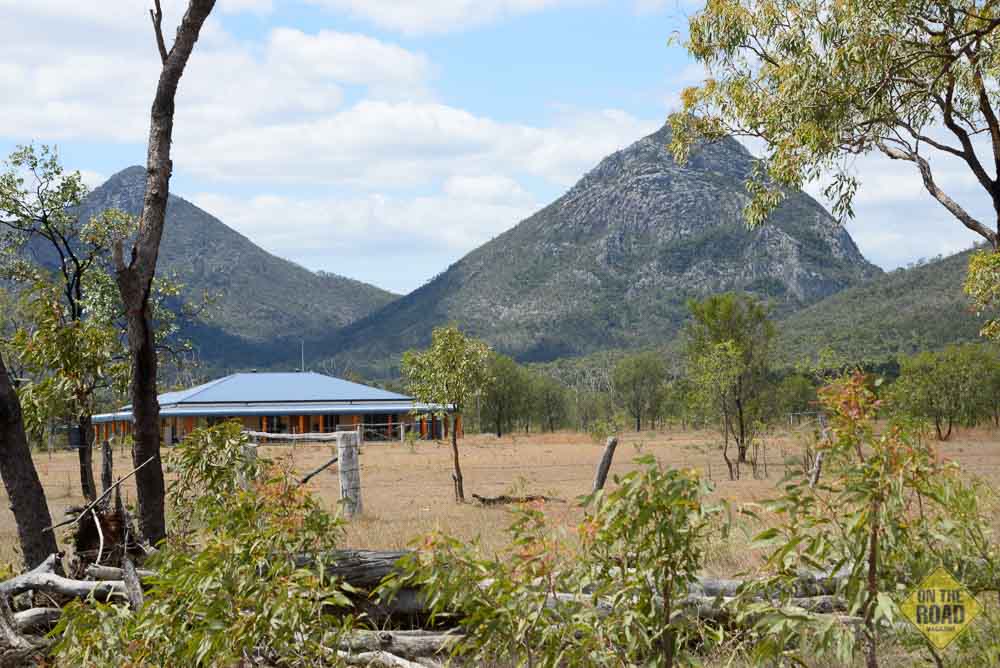
The Peak Range has always tantalized us when driving on the Gregory Development Road. The razor-sharp peaks can be seen from Capella but we never had the time to take a close look at this extraordinary range. In fact there is a number of high ranges and elevated plateaus on the routes we took that are not marked on road maps. Many, like the Blackdown Tableland, are national parks and well worth visiting.
We met a local station owner whose land includes part of the Peak Range. He was full of information and a great help by giving us permission to photograph the range from a station track. I cursed the clouds that were shading the land as I wanted full sun. The ideal time would have been in the morning or the afternoon, but unfortunately we did not have that privilege and had to make do with the time we had.
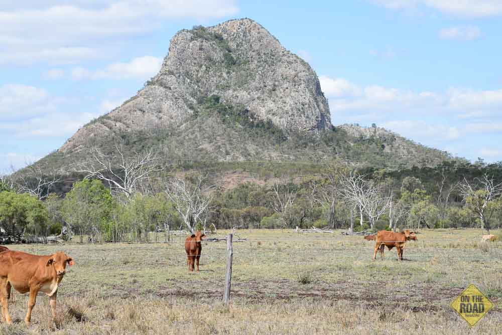
The range is locally called “The Peaks,” a chain of prominent and very picturesque ancient volcanoes. They were first observed by Dr. Ludwig Leichhardt who was full of praise for the wonderful box wood country that had replaced the “Bricklow” scrub. He named the magic mountain range “Coxen’s Peak and Range,” after a Mr. Coxen, one of his sponsors. The prominent peaks were named after members of the expedition. The peaks range from 430m to Scott’s peak at 854m high.
The Peak Range province consists of underlain and extensive basalt lava flows intermixed with intrusive rhyolite and trachyte bodies that erupted and were emplaced some 29 to 32 million years ago during the Tertiary Period. These are very old volcanoes as our other volcanoes were active about 23 million years and as late as 15,000 years ago (Atherton Tablelands.) The Peak Range only has a thin 30m thick basalt veneer with surrounding rich deep basaltic soils.
There are three distinct section of the range with the northern and southern parts consisting of closely formatted rhyolite and trachyte pinnacles and domes. The original volcanic plugs – all that remain from a huge volcano – rise magically from the relative flat country side and are visible from over 50km away from the west. The most obvious are Wolfgang Peak, Mount Castor and Mount Pollux, locally called the “German Twins.” Some peaks like Mount Castor and Mount McArthur are weathered and have cavernous features. Both Mount Roper and Scott’s Peak are collapsed domes that were built up by successive intrusions and upheaval of gelatinous lava pushing up their core plugs.
Other parts of range feature flat-topped mesas that are reminiscent of an American Wild West scene. These mesas and ridges were formed by flat-laying lava that forms scenic backdrops against cultivated fields. The range extends well to the north, but it is the southern peaks that are the most remarkable and outstanding. A couple of small underdeveloped national parks include Mount Castor and Pollux (Gemini Mountains) and Wolfgang Peak, while the Eastern Peak and Lords Table Mountain are accessible to fit hikers and climbers. The Coonburragee Road and the Capella-Dysart Road offer great views of the range. Parts of these roads are unsealed.
Close Road
From Dysart we headed towards Collinsville, passing huge coal mines, but even at 7.30pm on Sunday night we could not find a motel, a feed or a camp ground in the once thriving community that reportedly has been “bastardized” by mining companies who do not employ local labour, but use “Fly In Fly Outs” instead. We ended the long 1000km day at Bowen. En route we got “lost” by taking roads that ended at mines as the map we used had not been updated. Mines are taking over some roads and detours are installed but not always marked as such. The Moranbah to the Nebo – Collinsville Road shortcut, had a large sign that warned us it was a private road and we needed the mine manager’s permission to use it.
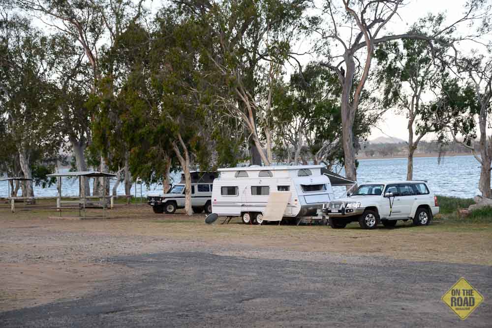
A passing trucker said to ignore it as the road is still maintained by the Qld Government. So we proceeded and discovered a nice impoundment with a lovely camp ground. I heard it has been stocked with barramundi. After the long easy, no-traffic roads of the Central Highlands, the Bruce Highway brought us back to the real world as we headed to Townsville and home via South Innisfail. We clocked up 4200km on the long journey without mishaps to us or the old Toyota Landcruiser.
It was a journey that anyone can do in the family car, though a 4WD would enable you to explore the many offroad and national parks attractions that the Central Highlands offer. The journey was an eye opener as the roads we took were a scenic journey that led us across wide open plains and downs country, under towering escarpments, across great mountain ranges, through wilderness woodlands and coastal rainforest, wetlands and pass huge coal mines, the lifeblood of the highlands. Only in Australia and you just have to go and see it for yourself…
Visit: www.centralhighlands.com.au for more information.