In the south eastern corner of NSW is a road that traverses wild countryside as it travels from the sea to Australia’s highest town and onto the western slopes.
There can’t be too many roads that have the variety and grandeur of the Snowy Mountains Highway in Southern NSW. Until a name change for the most eastern few miles of road a few years ago, it ran from the sea across the Great Dividing Range to the rolling hills of the western slopes.
On a recent journey we followed the road as it wound its way through fertile valleys, crossing the vast planes of the Monaro before carving a way across soaring ranges that become covered in snow during winter and finally swooping down to a vast dam and back into picturesque farmland.
Short detours took us to fairyland underground caves, Australia’s biggest engineering project and the country’s highest town as well as getting us in touch with a history of riches and disappointment.
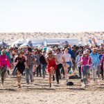
Our journey over the mountains started in Tathra, the spiritual stepping off point of the Highway. Wrapped around a sapphire blue sea, the town retains its small seaside village atmosphere and boasts the only remaining steamer wharf on the NSW coast. Fishing and surfing are high on the local radar with boats taking pride of place in many yards and the surf filled with grommets and greybeards in equal proportions.
The road between Tathra and Bega soon breaks out of the coastal range and into the expansive Bega Valley. We headed across Jellet Jellet Flat where the rich alluvial soils have created acres of productive farmland.
Bega is the centre of a still thriving dairy industry and home to Beqa Cheese. That’s not a mistake, the brand is supposedly spelt with a q to avoid copyright issues, but it’s one of the best-known cheddars in our country and is found on shelves across Asia and Europe. A tour of the factory on the northern bank of the Bega River is worth the short detour to even if only for the scones and tea with real milk.
We followed the Princes Highway not far out of town to the turnoff to Cooma and the now actual beginning of the Snowy Mountains Highway. Following a run of about 40kms through Bemboka and its famous pies we cross rolling green hills dotted with black and white Friesians and the occasional honey-coloured Jersey cows.
For miles we see the Great Divide looming ahead and we are soon at the foot of Brown Mountain, steep enough to have vehicles towing heavy vans back to first in some sections. Pipers Lookout at the summit can offer panoramic views to the coast along the boardwalk meandering through soaring Brown Barrel’s and tree ferns.
Snow falls here occasionally in winter and the ridges are often shrouded in thick mist that can dampen clothes in minutes. At the top of the tree line we broke out into the open pasture of the Monaro where sheep graze the grassy hills that spread for miles.
Nimmitabel has some welcoming cafes and a leather shop that attracts bikers and horsemen for the collection of jackets, belts and accessories. A walk around the town will uncover historical buildings including a deserted local pub that has seen better days.
Prominent among the old buildings is a stone windmill with a long history. German immigrant, John Geldmacher, took seven years to construct the tall structure almost single handed, but when it was finished in 1872 he was told that the shadow of the sails frightened passing horses and local authorities banned its use. He is said to have later converted it to a horse-powered mill so he seems to have got his own back on the equine troublemakers.
The run into Cooma crosses the abandoned railway line in a few places, reminding us of times past when things ran at a slower pace. Cooma is the business heart of the Monaro and home to the Snowy Mountains Engineering Corporation. Their Snowy Hydro Discovery Centre is not far from the town centre and its historic photos and interactive displays are a great place to learn about one of Australia’s greatest engineering achievements.
Our journey heads towards the snowfields of Thredbo and Perisher before veering west a few kilometres out of town and into the real essence of the Monaro where occasional granite outcrops weathered to huge rounded boulders across the landscape.
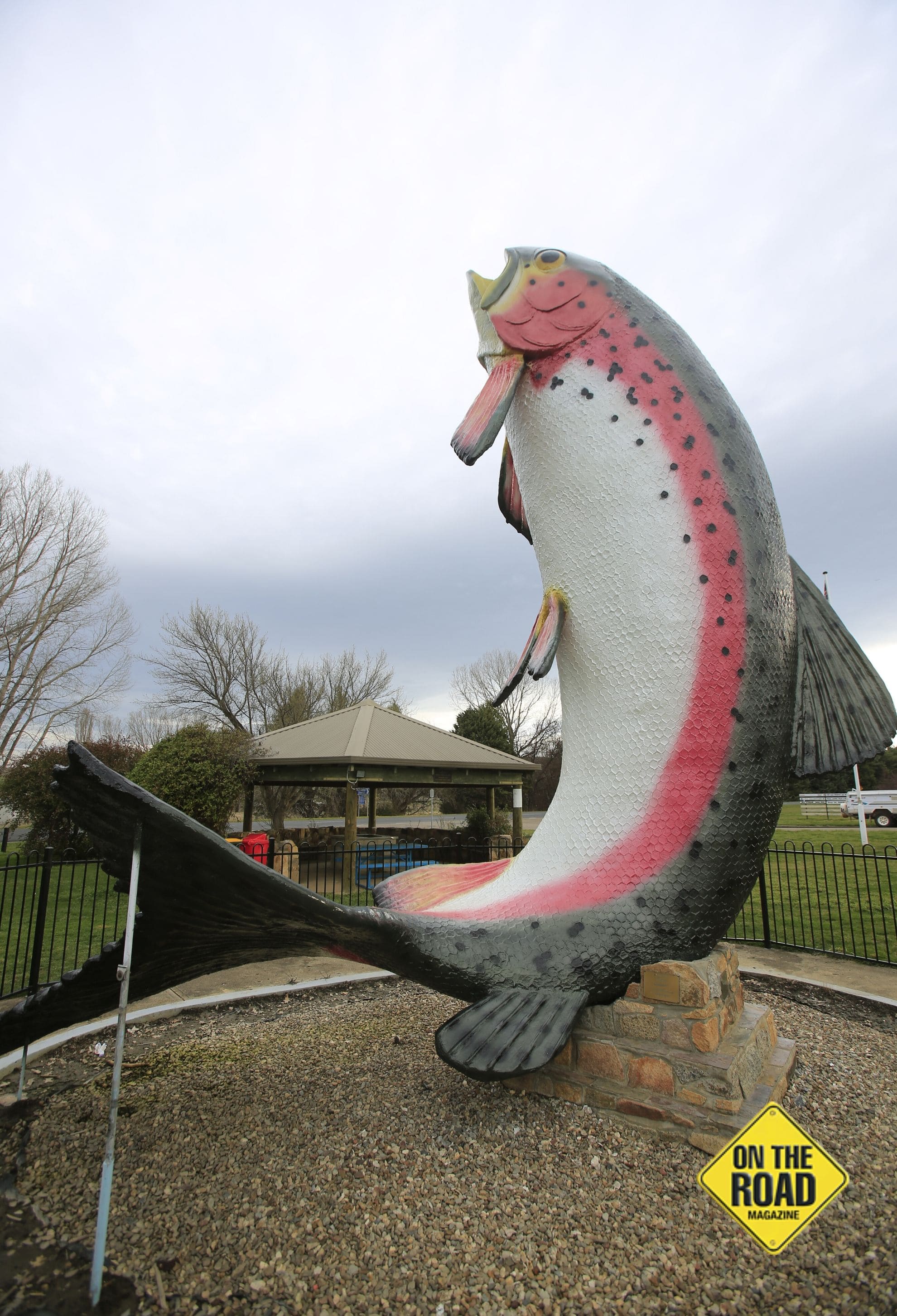
Fishermen would enjoy a detour to tempt a Lake Eucumbene trout onto a hook, but we settled for some photos and a cup of tea alongside the BIG Trout in Adaminaby.
By the time we reached the entrance to Kosciuszko National Park, open countryside had given way to stands of ash and snow gums as the road wound higher into the mountains. Kosciuszko is the largest park in NSW covering some 69,000 square kilometres and is home to Australia’s highest peak Mount Kosciuszko.
Not far into the park the road markings turn to yellow so they can be seen in snowy conditions and we drove through stands of dead trees that were the victim of raging bushfires approximately ten years ago that killed thousands of acres of forest.
Rangers have been disappointed to see that much of the timber has not regrown as might be expected and there is speculation that either the fire was so hot it killed seeds or the rainfall since has not been sufficient to enable new plants to germinate. Either way the sight of the white trunks of dead trees for miles across the valleys is eerie and sad.
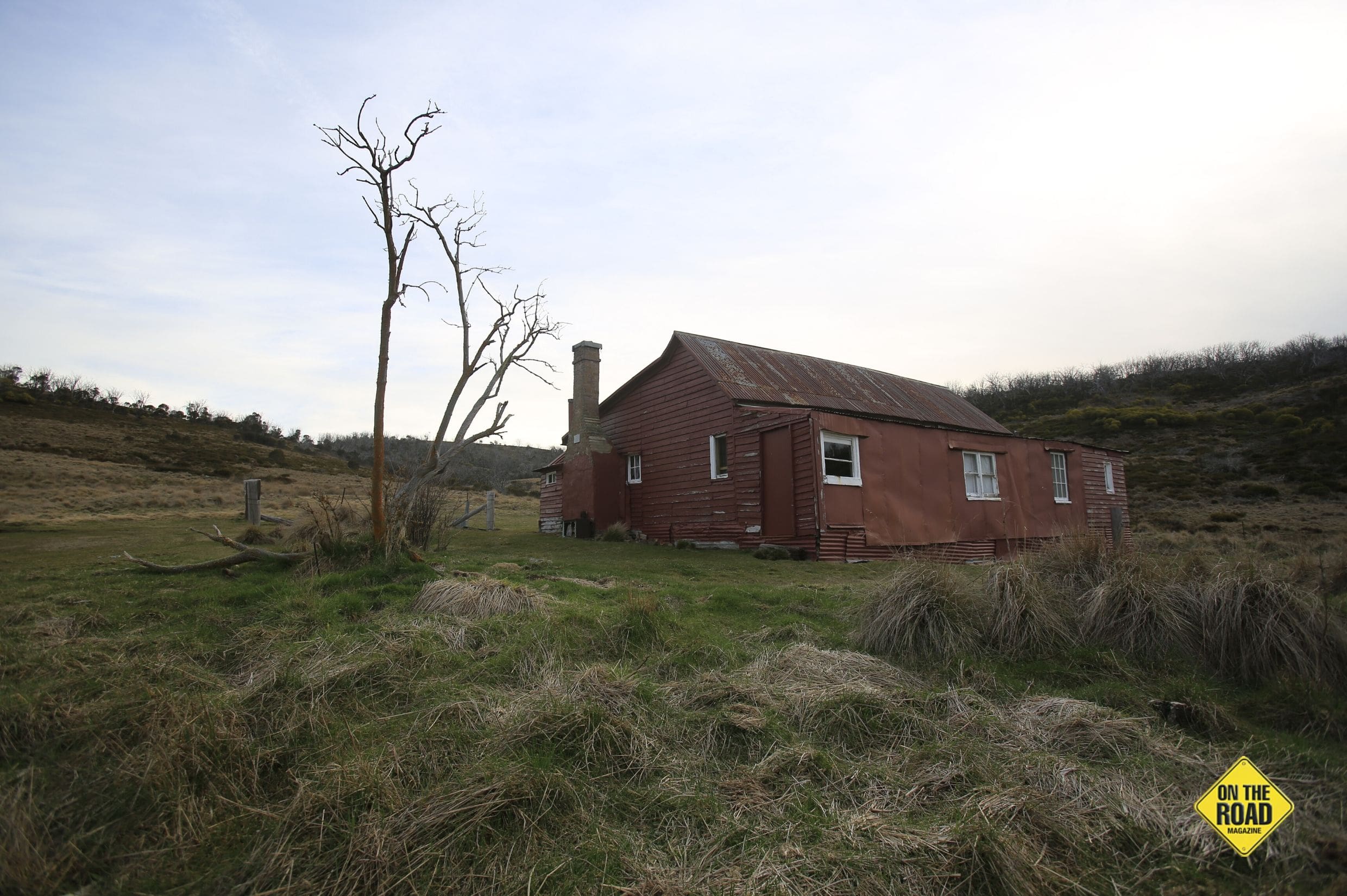
Sawyers Hut sits on the side of the road and its renovated vertical slab construction is true to the original hut built as a staging post for coaches heading to various gold fields in the mid 1800’s. Not far from here the road reaches its highest point at 1500m above sea level.
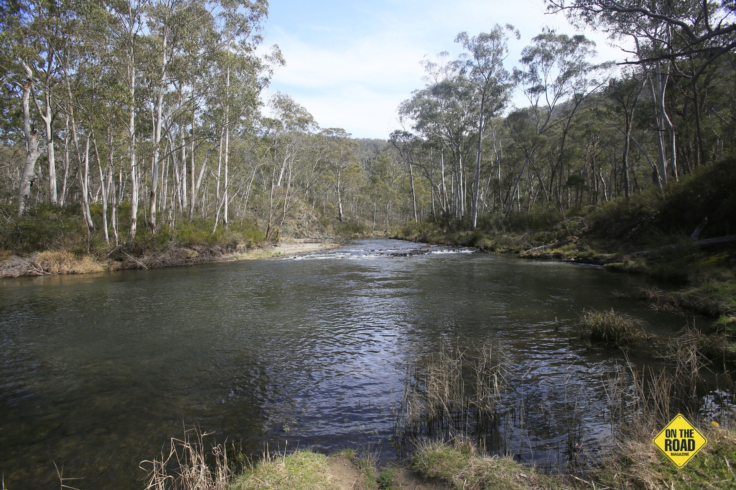
The view over Kiandra is stunning as boggy grassland spreads across the valley with the Eucumbene River a sliver of light in the afternoon sun.
At the height of a short-lived gold rush Kiandra was an exciting town of thousands of people and 14 hotels. These days it’s a shadow of its glory days because as buildings fell into disrepair, they were removed by National Parks. Now only a few houses and the courthouse remain, despite the town being the birthplace of Alpine Skiing in Australia. It is also the site of the world’s oldest ski club, which at one time boasted none less than Banjo Patterson as Vice President.
The Eucumbene is a mecca for trout fishermen in the open season between October and June and tracks leading along the bank no doubt hide secret fishing spots. I am told it is possible to camp here as long as you are not visible from the highway but of course there would be dire consequences for anyone straying from a made road.
We found a place to set up the Jayco about a kilometre off the main road, camping under a cloudless sky with millions of stars twinkling in the blackness. Our only company was an occasional high-flying plane rumbling away, well overhead.
Following breakfast by the river we headed west for a kilometre before turning down Khancoban Road to experience Cabramurra, Australia’s highest town, and for the spectacular views across the vast ranges towards Victoria. This detour also took us to the low key Mount Selwyn ski resort, which in early summer was deserted apart from a murder of crows stalking the carpark.
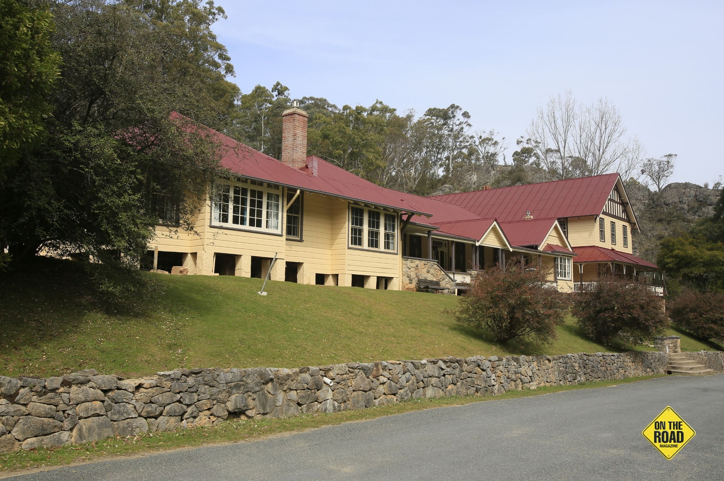
Back on track we headed west to the idyllic Yarrangobilly Village campground where we set up camp before backtracking to the road into Yarrangobilly Caves. This dirt track is well maintained and big vans would have no trouble winding their way down the ridges to the cave precinct.
Discovered in the mid 1800’s the place has had an interesting history including a period in the 60’s when state prisoners were housed here to work out their time improving facilities. An imposing guesthouse from 1901 thrived into the 1920’s and 30’s when the caves were considered one of NSW most popular tourist destinations. It retains a simple, bygone charm, which can be experienced by self catered group accommodation in wings of the restored building.
There are numerous caves scattered around the hillsides, with a few open to the public including the self-guided South Glory site.
We booked to tour the Jersey Cave with a promise of a variety of features and 217 steps along a sometimes-narrow 185m passageway into the darkness. The cave features mazes of limestone columns and pools, lit sympathetically to create beautiful scenes that have been formed over 745,000 years.
Our tour took about 90 minutes and the guide was knowledgeable and provided an interesting history, without rushing anyone, including dawdling photographers, who wanted to linger.
Before heading back to camp, where we anticipated the icy waters in the creek would be a bit much, we headed down to the thermal pool on the bank of the Yarrangobilly River. A walking track descends steeply into the valley to an underground spring flowing into a 20m concrete pool. With a constant temperature of 27deg it made for a pleasant swim in the warm early summer. We imagined it would be fun to swim here in winter with snow covering the surrounding park.
Back at Yarrangobilly Village the only building still standing is the well maintained Cotterill’s Cottage, which dates back to the 1890’s making it the oldest building in the park. Although it’s not far from the highway, only occasional big rigs disturbed the quiet camp during the night and we woke to find wallabies grazing only feet from the door of the Jayco.
From here the road follows ridges skirting the Bogong Peaks Wilderness Area to the top of Big Talbingo Mountain and a winding 500m-drop into a wide valley where the small township of Talbingo rests between Jounama Poindage and the expansive Blowering Dam.
Arriving in Talbingo gives a feeling of being back in civilisation after the relatively lonely trip across the mountains, where it might be miles before another vehicle is spotted. The town has a caravan park, general store and a visitor information centre with displays explaining the Tumut 3 power station.
There are numerous campsites along the shores of Blowering Dam and it offers fishing and all manner of water sports. If you decide to get the kayak out for a leisurely paddle, remember that it was on these waters that Ken Warby established his world boat speed record. His 1978 run of 317mph (511kph) still stands in the jet-powered Spirit of Australia that he designed and built in his backyard. Ken is said to be the only surviving person who has achieved more than 300mph on water.
Tumut is a thriving town with mills and a pine board plant fed by thousands of acres of radiate Pine from the surrounding hills. Walking tracks and cycle ways along the fast flowing Tumut River can be a photographers delight especially in Autumn when golden leaves cover a canopy of willows and poplars.
Further west is Adelong with its wide street and impressive period hotel. A detour not far from town takes you to the Adelong Falls Gold Mill where the remains of the water-driven facility rest beside the creek. The mill operated for nearly sixty years up to 1914, processing 30 tons of rock a day. Although flood, fire and looters have ravaged the site there is still a strong feeling of enterprise in the remaining stone buildings and it’s worth an hour or so to wander over the site.
Heading west again and after the solitude of the Snowy Mountains Highway it’s a bit of a shock when the road merges into the Hume Highway and we found ourselves suddenly amongst countless lines of trucks heading down to Melbourne.
Our trek across the Snowy had delivered on the promise to find much diverse country and weather. Those who cross in winter might find an even more remote landscape of howling wind and blinding snow. Whatever season there’s plenty to see and do and many varied campsites to spend a few days in the peace of this interesting corner of NSW.